Doncaster cropmarks reveal Roman and Iron Age archaeology ‘jigsaw’
A new, virtual aerial map from Historic England has revealed Roman and Iron Age archaeology around Doncaster and Rotherham in the form of settlements and field systems, concealed by modern crops and housing developments.
Historic England has pieced together over 30 years’ worth of aerial photographs which map out the nation’s hidden archaeological history.
According to the public body, “Like a huge archaeological jigsaw puzzle, the map pieces together archaeological landscapes recorded during analysis of over 500,000 aerial photographs.”
The map not only reveals South Yorkshire’s history but more than half of England’s as well, going as far back as 6,000 years ago.
The images were captured through airborne laser scanning (lidar data) which uses laser light to create three-dimensional landscapes of the Earth’s surface, Historic England revealed.
They added that the cropmarks take the form of “patterns […] when the colour and height of a crop is affected by buried archaeological features”.
They appear in hot and dry summers when photographed from the sky.
The project initially took place in 2005 and 2006, but archaeologists have reportedly been photographing Yorkshire from above for over five decades.
In West and South Yorkshire specifically, a Magnesian Limestone project has been uncovered by the virtual map.
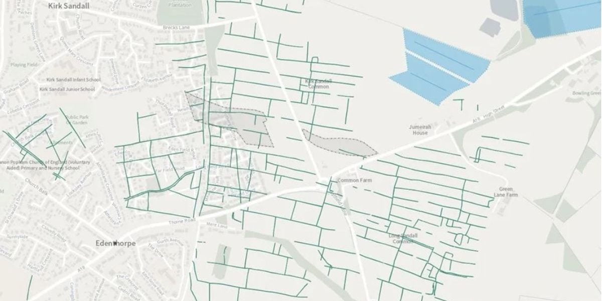
Historic England described the discovery of the Iron Age and Roman fields around Doncaster and Rotherham as “brickwork” patterns which indicates how the landscape was “extensively settled and farmed” hundreds of years ago.
They added that the patterns take the form of “long, parallel field boundaries divided by shorter cross boundaries”.
It is believed that the fields were used for livestock or settlements for farming communities.
Circular Iron Age huts can also reportedly be seen at times.
Duncan Wilson, Chief Executive of Historic England, said: “This new aerial archaeology mapping tool lets people fly virtually over England and drink in its many layers of history.
“It will allow everyone to explore the hidden heritage of their local places and what makes them special.
“We hope it will give people a springboard to further investigation, whether for research purposes or simply to satisfy curiosity about what archaeological features they may have noticed around their local area.”
Historic England’s work is still ongoing, so expect more magical discoveries in the future.
(Photo: Frame Edenthorpe field systems (Magnesian Limestone project) – Historic England)


